The road & its landscape
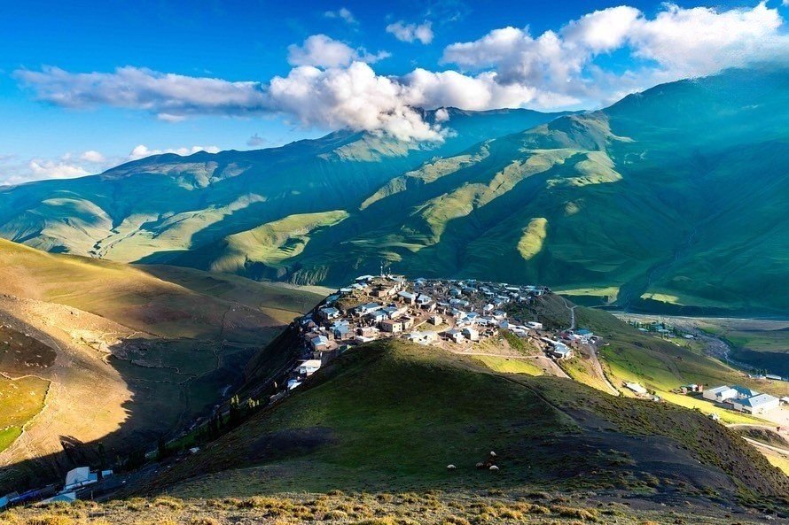
The Khinalig approach moves from a northern town into a high mountain village landscape.
Planning corridor: Guba → Khinalig.
Why ride here
The Khinalig approach moves from a northern town into a high mountain village landscape.
Scenery along the road
Above Guba, settled foothills give way to a deeper valley and exposed rock slopes. The Khinalig approach makes the changing mountain scale particularly clear, ending among clustered houses in an open highland basin. Pastoral tracks beyond the village are not treated as confirmed motor roads.
Guba
The town supplies the inhabited starting point before the mountain approach.
Mountain approach
Rock slopes and deep valley scenery progressively replace the lower town setting.
Khinalig
Clustered houses sit within a broad highland setting; surrounding transhumance trails are not assumed motor roads.
Roads from above
Look at the bends, road surface and landscape beside the carriageway. Each caption identifies the location; other roads in the range are marked separately.
AlexFirstov · CC BY-SA 4.0 · Thumbnail / display crop · Licence
AlexFirstov · CC BY-SA 4.0 · Thumbnail / display crop · Licence
Original: Matthew Hadley (nickname diff_sky) derivative work: Ximonic (talk), Simo Räsänen · CC BY 1.0 · Thumbnail / display crop · Licence
Road conditions & preparation
Check the road operator for snow closures and restrictions before departure.
Mountain landscapes
Photographs identify their actual location, author and licence. Viewpoints away from the riding corridor are stated in the captions; photographs are not verified ride records.
Sefer azeri · CC0 · Thumbnail / display crop · Licence
Ambigram0 · CC0 · Thumbnail / display crop · Licence
Nizinuri · CC BY-SA 4.0 · Thumbnail / display crop · Licence
Sources & provenance
Summarised from public sources. A historic tourism plan describes a corridor, not current road access. Track authors retain ownership of their files.