The road & its landscape
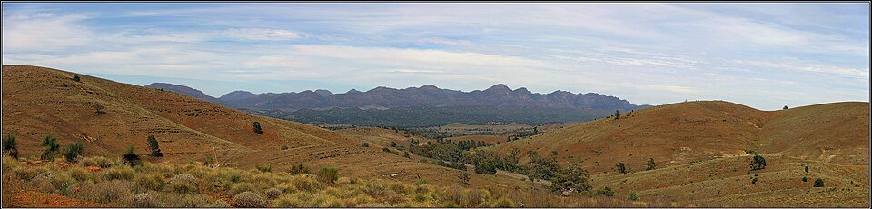
The sealed Hawker–Blinman road and Wilpena access give a road-bike approach to the central Flinders Ranges. Folded rock ridges rise from dry country, while the Wilpena stop sits beneath the mountain rim of Ikara.
A 6–9 November 2026 pest-control closure exempts Hawker–Blinman Road and Wilpena Resort, but other stops may be closed. Recheck the dated notices rather than treating the whole park as open.
Scenery along the road
North of Hawker, distant ridges gradually become a stronger foreground. The Wilpena approach brings the mountain walls closer; continuing towards Blinman, the public road runs through the ranges without requiring the unsealed gorge circuits.
Hawker mountain approach
Use the sealed northbound road as the surrounding ridges grow more prominent.
Wilpena visitor stop
The sealed access reaches services below Ikara; walks into the Pound are separate.
Blinman public-road finish
Continue on the main road between dry mountain slopes to the historic settlement.
Road conditions & preparation
Check SA outback-road reports, park alerts, heat and fuel before departure. On the 1 October 2026 alert, Bunyeroo Gorge remained closed and Brachina Gorge was 4WD-only. These are excluded. Do not infer gorge access from an older scenic photograph.
Mountain landscapes
Photographs identify their actual location, author and licence. Viewpoints away from the riding corridor are stated in the captions; photographs are not verified ride records.
Peter Neaum · CC BY 3.0 · Thumbnail / display crop · Licence
Peter Neaum · CC BY 3.0 · Thumbnail / display crop · Licence
Peter Neaum · CC BY 3.0 · Thumbnail / display crop · Licence
Sources & provenance
- SA Parks: Ikara-Flinders access and landscape ↗
- SA Parks: rain-damage restrictions, October 2026 ↗
- SA Parks: November 2026 partial closure and exemptions ↗
- SA transport: outback-road conditions ↗
Summarised from public sources. A historic tourism plan describes a corridor, not current road access. Track authors retain ownership of their files.