The road & its landscape
The Belgian Ardennes chapter follows river bends, forested hills and small castle towns.
Planning corridor: Durbuy → La Roche-en-Ardenne → Houffalize.
Why ride here
The Belgian Ardennes chapter follows river bends, forested hills and small castle towns.
Scenery along the road
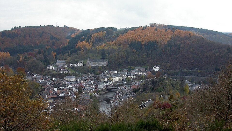
The Belgian Ardennes are read through wooded slopes and the changing bends of the Ourthe valley. Durbuy and La Roche-en-Ardenne provide stone-built town foregrounds beneath the hills. Climbing towards Houffalize exchanges the close river setting for forest and higher pasture.
Durbuy
Stone streets and the Ourthe valley introduce a lower, inhabited upland landscape.
La Roche-en-Ardenne
The river curves below wooded slopes and the castle; the town is a useful walking stop.
Houffalize
Climbing away from the river alternates forest and upland pasture; signed cycle paths are separate from the road.
Road conditions & preparation
Check the road operator for snow closures and restrictions before departure.
Mountain landscapes
Photographs identify their actual location, author and licence. Viewpoints away from the riding corridor are stated in the captions; photographs are not verified ride records.
DimiTalen · CC0 · Thumbnail / display crop · Licence
BoomBoomBeem / Beem · CC BY-SA 3.0 · Thumbnail / display crop · Licence
Jean-Pol GRANDMONT · CC BY 3.0 · Thumbnail / display crop · Licence
Sources & provenance
Summarised from public sources. A historic tourism plan describes a corridor, not current road access. Track authors retain ownership of their files.