The road & its landscape
Finland’s northwestern road approaches fell country beside the long border valley.
Planning corridor: Karesuvanto → Kilpisjärvi · E8.
Why ride here
Finland’s northwestern road approaches fell country beside the long border valley.
Scenery along the road
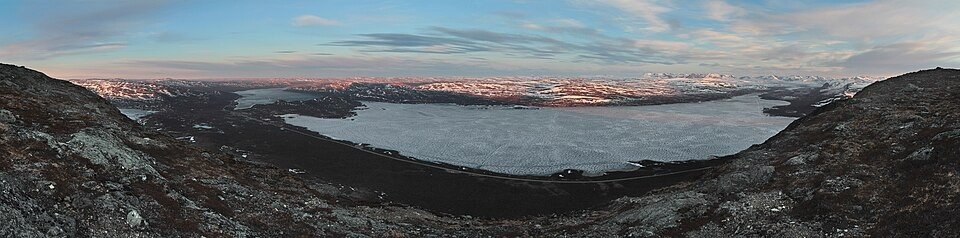
The E8 follows a long border valley rather than a steep pass ascent. North of Karesuvanto, thinning trees make the surrounding fell shapes increasingly visible. Kilpisjärvi and the Saana backdrop form the final mountain setting, while summit views require a separate walk.
Karesuvanto
The southern approach follows a river-valley landscape rather than a steep mountain pass.
E8 uplands
As the road heads north, trees thin and the wider fell setting becomes more prominent.
Kilpisjärvi and Saana
Lake and fell form the destination scene; reaching the fell summit requires a separate hike.
Roads from above
Look at the bends, road surface and landscape beside the carriageway. Each caption identifies the location; other roads in the range are marked separately.
Ximonic (Simo Räsänen) · CC BY-SA 4.0 · Thumbnail / display crop · Licence
Road conditions & preparation
Check the road operator for snow closures and restrictions before departure.
Mountain landscapes
Photographs identify their actual location, author and licence. Viewpoints away from the riding corridor are stated in the captions; photographs are not verified ride records.
Ximonic, Simo Räsänen · CC BY-SA 3.0 · Thumbnail / display crop · Licence
Ximonic (Simo Räsänen) · CC BY-SA 3.0 · Thumbnail / display crop · Licence
WikiLucas00 · CC BY-SA 4.0 · Thumbnail / display crop · Licence
Sources & provenance
Summarised from public sources. A historic tourism plan describes a corridor, not current road access. Track authors retain ownership of their files.