The road & its landscape
The road follows the glacier’s southern foothills; it does not cross the ice cap.
Planning corridor: Skaftafell → Fjallsárlón → Jökulsárlón → Höfn · Route 1.
Why ride here
The road follows the glacier’s southern foothills; it does not cross the ice cap.
Scenery along the road
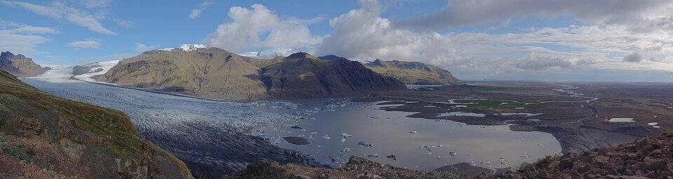
Route 1 stays beneath Vatnajökull, with glacier tongues descending towards wide gravel outwash plains. Around Skaftafell the mountain fronts feel close; farther east, changing gaps between the peaks reveal different ice tongues. Separate viewpoint stops should not be mistaken for a road across the ice cap.
Skaftafell
Glacier tongues descend from mountain slopes towards broad gravel plains.
Glacier lagoons
Fjallsárlón and Jökulsárlón are distinct shore-side stops reached off Route 1.
Towards Höfn
Mountain fronts alternate with low coastal ground, keeping the glacier landscape on the inland side.
Roads from above
Look at the bends, road surface and landscape beside the carriageway. Each caption identifies the location; other roads in the range are marked separately.
Other roads in this range
Some photographs show other roads, visitor access or historical alignments in this mountain region. Their captions identify the difference from this chapter’s main corridor; vehicle access is not inferred from the image.
Eysteinn Guðni Guðnason · CC BY-SA 4.0 · Thumbnail / display crop · Licence
Road conditions & preparation
Check the road operator for snow closures and restrictions before departure.
Mountain landscapes
Photographs identify their actual location, author and licence. Viewpoints away from the riding corridor are stated in the captions; photographs are not verified ride records.
Spike · CC BY-SA 4.0 · Thumbnail / display crop · Licence
Óðinn · CC BY-SA 2.5 ca · Thumbnail / display crop · Licence
Borvan53 · CC BY-SA 3.0 · Thumbnail / display crop · Licence
Sources & provenance
Summarised from public sources. A historic tourism plan describes a corridor, not current road access. Track authors retain ownership of their files.