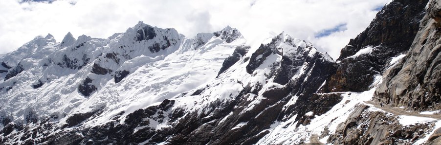
The road & its landscape
AN-107 crosses the Cordillera Blanca through the Ulta valley and Punta Olímpica tunnel. Cultivated foothills give way to a high, rocky valley beneath snow peaks before the road descends towards Chacas.
Use the present tunnel corridor. Old Punta Olímpica switchbacks, glacier approaches and climbing trails are not part of the verified public-road line.
Scenery along the road
The lower climb establishes the lived-in Andean slopes. In the Ulta valley, broad ground and high walls enlarge the view. The tunnel makes the modern crossing distinct from historic photographs of the old pass road above it.
Carhuaz and Shilla slopes
Settlements and cultivated slopes provide scale before the higher valley opens.
Ulta valley
Rock walls and snow-peak directions dominate the ascent; glacier viewpoints may be reached only on foot.
Tunnel and Chacas descent
The modern road passes through the tunnel and turns into the eastern valley; old high-pass images are identified separately.
Roads from above
Look at the bends, road surface and landscape beside the carriageway. Each caption identifies the location; other roads in the range are marked separately.
Other roads in this range
Some images show historic alignments or other roads within this mountain range. Captions identify them separately from the main riding corridor; none establishes current access.
Ondando · CC BY-SA 3.0 · Thumbnail / display crop · Licence
Road conditions & preparation
This is a very high-altitude corridor. Check Áncash transport notices, weather and protected-area arrangements; recent maintenance and landslide-clearance records do not guarantee access. Allow acclimatisation and avoid assuming assistance is immediately available.
Mountain landscapes
Photographs identify their actual location, author and licence. Viewpoints away from the riding corridor are stated in the captions; photographs are not verified ride records.
Roberto Flores · CC BY-SA 3.0 · Thumbnail / display crop · Licence
Lamder · CC BY-SA 4.0 · Thumbnail / display crop · Licence
Ondndo · CC BY 3.0 · Thumbnail / display crop · Licence
Sources & provenance
- Peru tourism inventory: Ulta valley and Punta Olímpica tunnel ↗
- Áncash transport authority: AN-107 clearance ↗
- Peru transport ministry: AN-107 road map ↗
Summarised from public sources. A historic tourism plan describes a corridor, not current road access. Track authors retain ownership of their files.