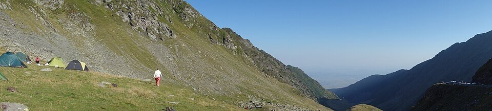
The road & its landscape
The Transfăgărășan crosses the Făgăraș mountains between a northern glacial basin and a wooded southern valley.
Planning corridor: Cârțișoara → Bâlea Lake → Vidraru → Curtea de Argeș · DN7C.
Why ride here
The Transfăgărășan crosses the Făgăraș mountains between a northern glacial basin and a wooded southern valley.
Scenery along the road
The DN7C climbs out of forest into the open northern basin of the Făgăraș mountains, where its stacked bends become visible against the slopes. Bâlea sits beside the pass tunnel. On the southern side, a longer wooded valley towards Vidraru changes the scene from exposed heights to enclosed terrain.
Northern ascent
Forest gives way to open slopes, making the upper hairpin sequence visible across the basin.
Bâlea Lake
The high lake sits beside the pass tunnel; parking and walking are needed for lakeshore views.
Vidraru
The southern road enters longer wooded valleys and reservoir country, changing the scale of the journey.
Roads from above
Look at the bends, road surface and landscape beside the carriageway. Each caption identifies the location; other roads in the range are marked separately.
Dariusz Grosa · CC0 · Thumbnail / display crop · Licence
Pudelek · CC BY-SA 4.0 · Thumbnail / display crop · Licence
Pudelek · CC BY-SA 4.0 · Thumbnail / display crop · Licence
Road conditions & preparation
Check the road operator for snow closures and restrictions before departure.
Mountain landscapes
Photographs identify their actual location, author and licence. Viewpoints away from the riding corridor are stated in the captions; photographs are not verified ride records.
Daniel Albrecht from Prague, Czech Republic · CC BY 2.0 · Thumbnail / display crop · Licence
Daniel Albrecht from Prague, Czech Republic · CC BY 2.0 · Thumbnail / display crop · Licence
BáthoryPéter · CC BY-SA 4.0 · Thumbnail / display crop · Licence
Sources & provenance
Summarised from public sources. A historic tourism plan describes a corridor, not current road access. Track authors retain ownership of their files.