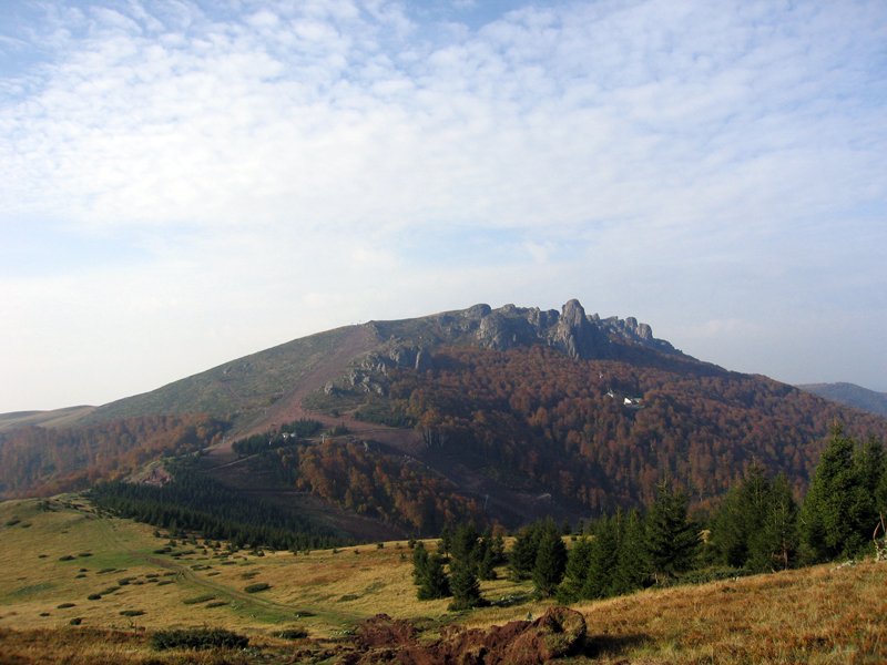
The road & its landscape
Serbia’s Stara Planina is part of the Balkan mountain range along the Bulgarian frontier. The public-road approach from the Pirot side through Kalna reaches settled uplands and the Babin Zub resort area. This chapter follows the documented visitor road and stops before mountain walking routes and protected summit terrain.
The public Stara Planina operator lists the Pirot–Kalna–Babin Zub approach; the hotel identifies the Kalna access via roads 221/222. This selected approach excludes ski slopes, Midžor summit trails, reserve tracks and any Bulgarian border crossing. Parking and resort entry conditions must be checked separately from the through-road.
Scenery along the road
The approach changes from inhabited valley roads to greener upland folds. Around Crni Vrh the village setting keeps the journey connected to everyday mountain life, while the upper access gives a broader sense of the Stara Planina slopes. Clear ridge views are weather-dependent and do not imply that the ridge itself is motorable.
Pirot–Kalna approach
Use the documented main-road connection and confirm the Kalna turn rather than forest shortcuts.
Crni Vrh village
Slow through the settlement and check the upper road before continuing.
Babin Zub arrival boundary
Finish at authorised access parking; continue towards viewpoints only on permitted walking routes.
Road conditions & preparation
Check current Serbian road information and the resort before the ascent. High ground can retain snow or ice well beyond town conditions, and the operator’s general good-road description is not a live surface guarantee. Allow for narrow bends, road repairs and rural traffic; confirm fuel at the lower settlements and finish in daylight.
Mountain landscapes
Photographs identify their actual location, author and licence. Viewpoints away from the riding corridor are stated in the captions; photographs are not verified ride records.
Snežana Trifunović · CC BY-SA 3.0 · Thumbnail / display crop · Licence
DjordjeMarkovic · CC BY-SA 4.0 · Thumbnail / display crop · Licence
Milos Krstic · CC BY-SA 3.0 · Thumbnail / display crop · Licence
Sources & provenance
- Stara Planina public operator: road approaches and mountain context ↗
- Stara Planina hotel: Kalna access roads ↗
Summarised from public sources. A historic tourism plan describes a corridor, not current road access. Track authors retain ownership of their files.