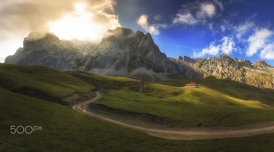
The road & its landscape
This valley road approaches the Picos limestone walls without turning the summit trails into a motor route.
Planning corridor: Potes → Fuente Dé · CA185.
Why ride here
This valley road approaches the Picos limestone walls without turning the summit trails into a motor route.
Scenery along the road
From Potes, the road follows a green inhabited valley towards the limestone mass of the Picos de Europa. Pasture below the peaks brings the rock walls progressively closer. Fuente Dé ends the motor-road chapter beneath a glacial cirque; the cable car and upper trails form a separate mountain visit.
Potes
Stone buildings and converging valleys introduce the inhabited foothills.
Camaleño valley
The road follows a greener valley while limestone peaks rise increasingly close above the pastures.
Fuente Dé
The road reaches a glacial amphitheatre; the cable car and upper trails require a separate excursion.
Roads from above
Look at the bends, road surface and landscape beside the carriageway. Each caption identifies the location; other roads in the range are marked separately.
Other roads in this range
Some photographs show other roads, visitor access or historical alignments in this mountain region. Their captions identify the difference from this chapter’s main corridor; vehicle access is not inferred from the image.
ROSUROB · CC BY-SA 3.0 es · Thumbnail / display crop · Licence
LBM1948 · CC BY-SA 4.0 · Thumbnail / display crop · Licence
Punteador · CC BY-SA 4.0 · Thumbnail / display crop · Licence
Road conditions & preparation
Check the road operator for snow closures and restrictions before departure.
Mountain landscapes
Photographs identify their actual location, author and licence. Viewpoints away from the riding corridor are stated in the captions; photographs are not verified ride records.
Antonio Aliaga Ibarra · CC BY 3.0 · Thumbnail / display crop · Licence
Eagletusk · CC BY-SA 4.0 · Thumbnail / display crop · Licence
JConnolly74 · Public domain · Thumbnail / display crop · Licence
Sources & provenance
Summarised from public sources. A historic tourism plan describes a corridor, not current road access. Track authors retain ownership of their files.