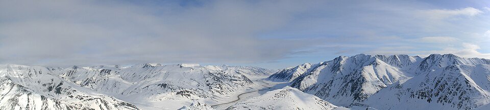
The road & its landscape
The Dalton Highway offers an established public-road crossing of the Brooks Range at Atigun Pass. This chapter selects the mountain section north of Coldfoot and a planned return, rather than assuming every rider should continue to the Arctic coast. It is a remote gravel-road journey for riders already comfortable with loose surfaces and long gaps in support.
Alaska DOT explicitly identifies motorists and motorcyclists among Dalton users and describes a mixture of gravel, dirt and intermittent pavement. This chapter remains on the highway; tundra, wildlife tracks and pipeline service roads are excluded. Galbraith is a turnaround area, not a promised fuel stop. Deadhorse and Arctic Ocean access require a separate itinerary.
Scenery along the road
Forested country around Coldfoot gives way to exposed mountain walls and a higher, more open approach to Atigun. North of the divide, the scenery spreads into treeless ground, with the Galbraith area providing a clear boundary for this selected ride. Weather can erase these contrasts quickly: low cloud and snow remain possible even during the warmer months.
Coldfoot preparation
Confirm fuel, weather and the complete out-and-back plan before heading north.
Chandalar Shelf–Atigun Pass
The steep mountain sector is the riding focus. Snow, loose material and commercial traffic take priority over stopping for a view.
Galbraith area and return
End the selected northbound leg here and return on the confirmed highway, retaining enough fuel and time for changing conditions.
Road conditions & preparation
Plan a snow-free riding window and check Alaska 511, DOT works and BLM advice immediately before departure. A highway maintained year-round is not a year-round motorcycle recommendation. Carry fuel for the confirmed return, puncture and repair equipment, food, warm layers and emergency communication. Let haul trucks pass safely; do not stop on the carriageway or rely on mobile coverage.
Mountain landscapes
Photographs identify their actual location, author and licence. Viewpoints away from the riding corridor are stated in the captions; photographs are not verified ride records.
Somebaldguy · CC BY-SA 3.0 · Thumbnail / display crop · Licence
Scott McMurren · CC BY 2.0 · Thumbnail / display crop · Licence
Sources & provenance
- Alaska DOT: Dalton Highway and motorcycle use ↗
- BLM: Atigun Pass landscape and stopping advice ↗
- Alaska 511: current conditions ↗
Summarised from public sources. A historic tourism plan describes a corridor, not current road access. Track authors retain ownership of their files.