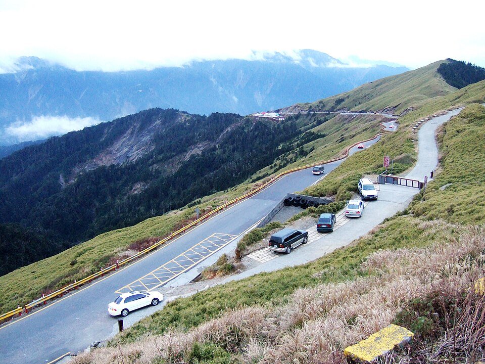
The road & its landscape
Route 14A climbs from Wushe through Qingjing into the Hehuanshan high mountain landscape. Settlements and pasture give way to forest, then to bamboo-covered slopes and much wider mountain views near Kunyang and Wuling. The changing roadside vegetation makes the climb visible even before the distant peaks become the main subject.
Road corridor: Wushe → Qingjing → Kunyang / Wuling · Route 14A.
Why ride here
Route 14A climbs from Wushe through Qingjing into the Hehuanshan high mountain landscape.
Scenery along the road
This road can be read as a progression of vegetation and space. Wushe and Qingjing bring houses and cultivated mountain slopes into view. Higher up, conifers and bamboo change the texture beside the road. Near Kunyang and Wuling, lower vegetation reveals more of the surrounding mountain contours. Light, passing cloud and the direction of the ridge create different views from the same authorised stopping places.
Wushe to Qingjing mountain slopes
The lower chapter combines mountain settlements with cultivated slopes and pasture around Qingjing. Buildings and human activity form the nearer scene, with wooded ridges behind them. The road’s rising direction is felt through the changing relationship between the settled hillsides and the wider mountain setting.
Meifeng–Yuanfeng forest transition
Higher road sections move through a changing mountain-forest setting. Conifers and alpine bamboo give different textures to the slopes: darker upright trees contrast with lower, more continuous vegetation. This chapter makes the transition towards Hehuanshan’s more exposed mountain contours particularly easy to notice.
Kunyang–Wuling high mountain views
Near Kunyang and Wuling, low vegetation leaves more of the Hehuan and Qilai mountain contours in view. The road provides a close foreground against successive ridges and moving cloud. Separate summit trails offer higher viewpoints; the road chapter is the broad mountain landscape seen from authorised roadside stops.
Roads from above
Look at the bends, road surface and landscape beside the carriageway. Each caption identifies the location; other roads in the range are marked separately.
Dquai · CC BY-SA 4.0 · Thumbnail / display crop · Licence
Jen-Yu, Tsai · CC BY-SA 4.0 · Thumbnail / display crop · Licence
Road conditions & preparation
Choose the exact public-road connections first, then check road works, local motorcycle access and scenic-area transport. Plan stops at confirmed parking areas and add fuel and lodging information to the roadbook.
Mountain landscapes
Photographs identify their actual location, author and licence. Viewpoints away from the riding corridor are stated in the captions; photographs are not verified ride records.
Person Lin · CC BY-SA 2.0 · Thumbnail / display crop · Licence
realhydee · CC BY-SA 2.0 · Thumbnail / display crop · Licence
Dquai · CC BY-SA 4.0 · Thumbnail / display crop · Licence
Sources & provenance
- Route 14A: Wushe–Qingjing–Hehuanshan sequence ↗
- Forestry Agency: Hehuanshan forest recreation area ↗
- Cingjing Farm: Route 14A landscape ↗
Summarised from public sources. A historic tourism plan describes a corridor, not current road access. Track authors retain ownership of their files.