The road & its landscape
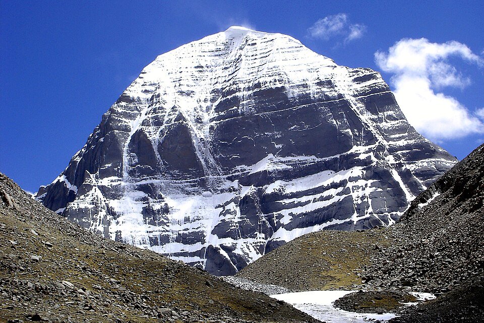
Around Baga and Darchen, the G219 journey places Gangdise’s mountain forms against a broad western Tibetan sky. Kailash gives the region a recognisable distant landmark; the lake country towards Purang adds water and a different horizon to the mountain-road setting.
Road corridor: G219 Baga / Darchen; G564 lake country → Purang.
Why ride here
Around Baga and Darchen, the G219 journey places Gangdise’s mountain forms against a broad western Tibetan sky.
Scenery along the road
G219 near Baga frames Kailash with open high ground and, at the documented viewing direction, a small stream in the foreground. Darchen brings settlement scale to the foot of the range. The G564 lake-country approach towards Purang changes the scene again: Mansarovar and Rakshastal broaden the water view, before the Peacock River valley introduces a greener, inhabited landscape.
G219 towards Baga
Near the Baga–Purang junction, the official G219 account describes a small stream beneath the Kailash view. Water makes a closer foreground against the open high ground and distant mountain shape. The contrast gives this road-side viewing direction more depth than a mountain-only portrait.
Darchen mountain-front setting
Darchen brings buildings and visitor activity into the mountain-front view. The inhabited foreground makes the range’s scale easier to read. Beyond the settlement, Kailash’s distinctive form gathers attention, contrasting with the wider and more horizontal scenery of the surrounding high country.
G564 lakes towards the Peacock River valley
On the G564 direction, Mansarovar and Rakshastal open the foreground into lake water. Continuing towards Purang brings the greener, inhabited Peacock River valley into the chapter. Lake surfaces, highland slopes and river-valley settlement give this southern branch three distinct visual textures.
Road conditions & preparation
Build the route in stages around altitude, weather, fuel and accommodation. Check current road notices and the transport arrangements at each scenic-area entrance before choosing the riding line. Pilgrimage paths and the Kailash walking circuit are separate from public-road travel. Follow current scenic transport and access arrangements.
Mountain landscapes
Photographs identify their actual location, author and licence. Viewpoints away from the riding corridor are stated in the captions; photographs are not verified ride records.
Ondřej Žváček · CC BY 2.5 · Thumbnail / display crop · Licence
Ondřej Žváček · CC BY 2.5 · Thumbnail / display crop · Licence
Jean-Marie Hullot · CC BY-SA 4.0 · Thumbnail / display crop · Licence
Sources & provenance
Summarised from public sources. A historic tourism plan describes a corridor, not current road access. Track authors retain ownership of their files.