The road & its landscape
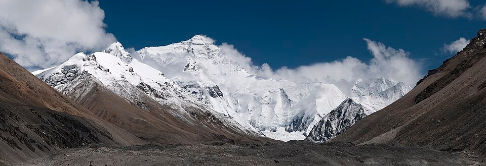
The Everest approach changes from Tingri’s high plateau country into a road shaped by mountain slopes and deep valleys. At Gyawu La, the foreground road and the distant Himalayan skyline share the view; farther towards Rongbuk, the mountain scene becomes more concentrated around the Everest-facing valley.
Road corridor: Tingri / G318 approach → Gyawu La → Rongbuk-facing scenic approach.
Why ride here
The Everest approach changes from Tingri’s high plateau country into a road shaped by mountain slopes and deep valleys.
Scenery along the road
The approach changes from open plateau to a mountain panorama, then into a valley-facing view of Everest. The G318-side approach establishes the high plateau setting. Gyawu La then opens a wide mountain panorama when cloud allows, while the road below explains the relief of the slope. The final Everest-viewing chapter belongs to the managed scenic approach near Rongbuk. The visual progression is from a wide plateau to a snow-peak panorama and finally a valley aligned towards Everest.
Tingri: G318-side approach
The Tingri approach supplies the wide setting before the close mountain views. Read the road against the high plateau and distant ridges rather than expecting Everest to dominate every kilometre. This opening gives the later pass panorama its contrast: first a broad inhabited plateau region, then a more dramatic mountain edge.
Gyawu La mountain panorama
At Gyawu La, look across the road-shaped slope towards the Himalayan skyline. A Chinese National Geography field account describes several very high peaks visible from this pass. Cloud can hide one ridge and reveal another, changing the spacing and contrast between the dark foreground slopes and the bright distant peaks.
Rongbuk-facing scenic approach
Towards Rongbuk, the panorama becomes a valley-directed view towards Everest. The regional tourism authority identifies the Rongbuk area as a visitor viewing location and distinguishes it from the protected core farther above. The nearer valley walls narrow the composition, giving the distant peak a more concentrated presence than in the wide panorama at the pass.
Roads from above
Look at the bends, road surface and landscape beside the carriageway. Each caption identifies the location; other roads in the range are marked separately.
STW932 · CC0 · Thumbnail / display crop · Licence
Road conditions & preparation
Build the route in stages around altitude, weather, fuel and accommodation. Check current road notices and the transport arrangements at each scenic-area entrance before choosing the riding line. Follow current Everest scenic transport and protected-area arrangements; the third-party motorcycle recording is historical evidence, not access confirmation.
Mountain landscapes
Photographs identify their actual location, author and licence. Viewpoints away from the riding corridor are stated in the captions; photographs are not verified ride records.
Ggia · CC BY-SA 3.0 · Thumbnail / display crop · Licence
Luca Galuzzi ( Lucag ) · CC BY-SA 2.5 · Thumbnail / display crop · Licence
STW932 · CC0 · Thumbnail / display crop · Licence
Sources & provenance
- Official geography / road information — Himalaya ↗
- A field account of Himalayan views at Gyawu La ↗
- Everest scenic viewing and protected-area boundary ↗
- Tingri EBC to Old Tingri: public motorcycle record ↗
Summarised from public sources. A historic tourism plan describes a corridor, not current road access. Track authors retain ownership of their files.